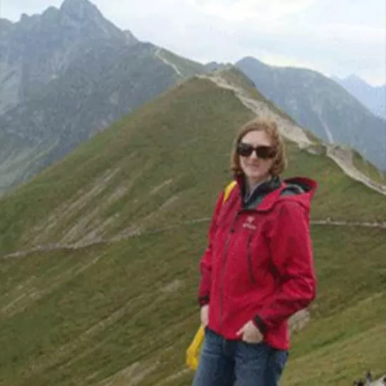
Alexis Robinson
-
E-mail:
Research and Professional Interests
My research interests include: lake ice climate interactions, modelling, remote sensing and cold region hydrology. My current research focus is on improving our current understanding of the latitudinal differences in ice characteristics and how this can be used to model current and projected temporal and spatial changes in ice regimes (e.g. formation, growth and decay), to determine how well the current surface energy balance is simulated and how potential changes to the surface energy budget will influence future ice conditions. The fieldwork for this research is being conducted in the High Arctic (Cornwallis and Bathurst Island) and in central Ontario (Haliburton, ON).
Why Geography, Geomatics and Environment at UTM?
I chose UTM because my research direction aligns well with my supervisor Prof. Laura Brown. Additionally, I would be able to conduct research both in Southern Ontario and in the High Arctic, which provides me with important research experience. My final reason for selecting UTM is its proximity to where I live and the generous financial support that is being provided.
Honours and Awards
- 2019-2020 Queen Elizabeth II Scholarship in Science and Technology
- 2019-2020 Oscar J Marshall Graduate Fellowship
- 2017-2018 Oscar J Marshall Graduate Fellowship
- 2017-2018 University of Toronto Fellowship & Tuition Award
- 2016-2017 University of Toronto Fellowship & Tuition Award
- 2016 – 2017 Department of Geography and Planning Entrance Award
- 2014 – 2016 Ryerson Graduate Fellowship
Presentations
Oral Presentations
- Robinson, A.*, Ariano, S. & Brown, L. C. (2018). Refining Lake Ice Simulations for Temperate Region Lakes: Haliburton Ontario. Oral Presentation at the University of Toronto Mississauga Graduate Research Colloquium, Mississauga, ON May 6-7, 2019.
- Robinson, A.*, Ariano, S. & Brown, L. C. (2018). Improving Lake Ice Simulations for Temperate Region Lakes. Oral Presentation at the American Geophysical Union Annual Meeting, Washington, DC December 10-14, 2018.
- Oswald, C., Rinner, C. & Robinson, A*. (2018). Applications of 3D Printing in Physical Geography Education and Urban Visualization. Oral Presentation presented by C Rinner at the Annual Canadian Cartographic Association meeting, Lawrencetown, Nova Scotia.
- Robinson, A., Ariano, S. & Brown, L.C. (2018). Modelling Ice Melt for Ontario versus Arctic Lakes. Oral Presentation at the Haliburton Forest Research Day 2018. Haliburton, ON
- Robinson, A., Oswald, C.J. & Atkinson, D.M. (2016, May). Spatial and Temporal Modeling of Current and Predicted Hydrological Processes of a High Arctic Watershed, Pond Inlet Mittimatalik), NU. Oral presentation at the annual meeting of the Canadian Geophysical Union, Fredericton NB.
Guest Lecture
- April 3, 3018- Guest Lecture (Ryerson University Geography – Advanced Remote Sensing): River Restoration Change Detection for the Skjern River, Denmark.
- March 28, 2018 – Guest Lecture (Ryerson University Geography – Global Water Issues): Climate Change and Water Issues in the North. Robinson, A. (2018).
- March 28, 2017 – Guest Lecture (Ryerson University Geography – Advanced Remote Sensing): River Restoration Change Detection for the Skjern River, Denmark.
- March 21, 2017- Guest Lecture (UTM Geography – GGR311 Landscape Biogeography): Robinson, A. (2017). Guest Lecture – Parks and Protected Areas.
Poster Presentations
- Robinson, A, & Brown, L.C. (2019). A Comparison of Simulated and Observed Lake Ice Cover in Canada. International Union of Geodesy and Geophysics (IUGG) Conference, July 8-18, 2019, IUGG, Montreal, PQ
- Robinson, A, & Brown, L.C. (2019). Comparing Simulated and Observed Lake Ice Freeze-up, Melt-onset and Break-up Dates in Canada. Canadian Geophysical Union: Eastern Student Conference, April 13, 2019, Toronto, On (Ryerson University).
- Robinson, A*, Ariano, S. & Brown, L.C. (2018). Modelling Lake Ice Melt-onset and Breakup Dates from Southern Ontario to the High Arctic. Canadian Geophysical Union Conference, June 10-14, 2018, Canadian Geophysical Union, Niagara Falls, ON.
- Robinson, A*, Ariano, S. & Brown, L.C. (2018). Modelling Melt-onset and Breakup Dates from Southern Ontario to the High Arctic. Canadian Geophysical Union Eastern Student Meeting, Western University, London, ON.
- Robinson, A*, Ariano, S. & Brown, L.C. (2018). Modelling Lake Ice Melt-onset and Breakup Dates from Southern Ontario to the High Arctic. UTM Annual Graduate Research Colloquium, April 30th, 2018, University of Toronto Mississauga, Mississauga, ON
- Robinson, A.*, Brown, L. C. (2017). Modeling High Arctic Lake Ice using CLIMo. Canadian Geophysical Union Conference, May 28-June 1st, 2017, Canadian Geophysical Union, UBC, Vancouver, B.C.
- Robinson, A.*, Brown, L. C. (2017). Modeling High Arctic Lake Ice using CLIMo. Canada’s Changing Arctic: Walking on Thin Ice, Arctic Research Symposium, September 21-22nd, 2017, University of Toronto Mississauga, Mississauga, ON.
- Murfitt, J., Robinson, A.*, Brown, L. C. (2017).Canadian Lake Depth Inventory using Landsat 8 OLI/TIRS. Canadian Geophysical Union Conference, May 28-June 1st, 2017, Canadian Geophysical Union, UBC, Vancouver, B.C.
- Robinson, A., Atkinson, D.M. & Oswald, C.J. (2016, February). Watershed identification and calculation of (hydrologic) topographical indices for Pond Inlet (Mittimatalik), NU for the eventual purpose of Hydrological Modeling. Poster presentation at the student meeting of the Canadian Geophysical Union– Easter Conference, Waterloo, ON.
- Robinson, A., Atkinson, D.M. & Oswald, C.J. (2015, October). Hydrologic Response Unit delineation of the Pond Inlet (Mittimatalik) Watershed for the purpose of Hydrological Modeling. Poster presentation at the student meeting of the Canadian Association of Geographers—Ontario Division Meeting, Ottawa, ON.
- Robinson, A., Atkinson, D.M. & Oswald, C.J. (2015, June). Spatially Explicit Hydrological Model Evaluation for a High Arctic Watershed. Poster presentation at the annual meeting of the Canadian Association of Geographers, Vancouver, BC.
- Ryerson Thesis Poster Presentation: Robinson, A.*, Atkinson, D.M. & Oswald, C.J. (2015). Spatiotemporal modelling of the Pond Inlet (Mittimatalik) watershed.
- Ryerson Cartography Poster Presentation: Robinson, A. (2014). Dasymetric Map of Total Residential and Commercial Water Consumption in 2013 by Land-use in Toronto
Publications
- Oswald, C.J., Rinner, C., & Robinson, A.. (2019). Applications of 3D printing in physical geography education and urban visualization. Cartographica. In Press.
