Finding Fault: Searching for ancient earthquakes in Argentina
The lush green hills of the Philippines might seem worlds away from the arid, rocky plateaus of the Argentinian Andes, but for U of T Mississauga earth scientist Jeremy Rimando, the two places share a shaky connection.
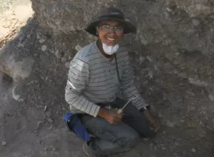
As a PhD candidate working in the lab of associate professor Lindsay Schoenbohm, Rimando specializes in paleoseismology, examining geologic sediments and rocks for signs of ancient earthquakes. Studying faults—cracks in the rocks that form the earth’s crust—provides clues into how the existing terrain was formed and what movements might change it in the future. “In my research, I describe the faulting and folding of the earth, and try to determine the rate the fault is moving,” he says. “A tectonic plate may move 10 centimeters per year, while a fault line may shift just a millimeter or two. But if force is applied to a geologic structure, like a crack in the ground, it’s likely to move much more and cause an earthquake.”
The movement of the earth beneath his feet has long fascinated Rimando. “At home, I felt the earth move every day,” he says of his childhood in the Philippines. “It’s very common to feel magnitude 4 earthquakes every day.” Comprised of 72 islands, the country is located within a tectonic region known as the Pacific “Ring of Fire” and is one the most seismically active places on earth. Those daily rumbings piqued Rimando’s curiosity about how and why the earth moves as it does. In 2013, when an unknown fault line succumbed to tectonic force, the country experienced a 7.2 magnitude quake—one of the deadliest to occur in nearly two decades. For Rimando, then a master’s student, the earthquake offered a chance to put his expertise into practice. “It was a rare opportunity to study a reverse faulting—where block of earth moves on top of another,” he says. “The North Bohol Fault had not been previously mapped, so the earthquake was a surprise to everyone.”

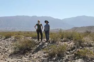
While Rimando’s research is primarily concerned with ancient earth movement, the data is directly applicable to modern day. About 200,000 people live in nearby Mendoza and San Juan, two cities that lie about an hour’s drive from the field site. Like the Philippines, minor earthquakes are a regular occurrence. San Juan was nearly leveled by a quake in 1944. “This information is critical for seismic hazard assessment,” Rimando says. “Places where faults are moving faster need to be studied more closely so planners and zoning experts can recommend precautionary measures, like better building design requirements.”
“It’s difficult to predict when a future earthquake will happen,” he says. “But if you know how big earthquakes were in the past and the frequency that they occurred, you can better predict what might happen in the future.”
Next year, Rimando will return to Argentina to conduct further research and he’s still mulling where he might go next. “I thought I would return to the Philippines to become a professor, but with the opportunity I’ve been given at UTM, I’ve seen the bigger world around me,” he says. “I’m now open to studying wherever the opportunity presents itself. The world will be my laboratory.”

